Table of Contents
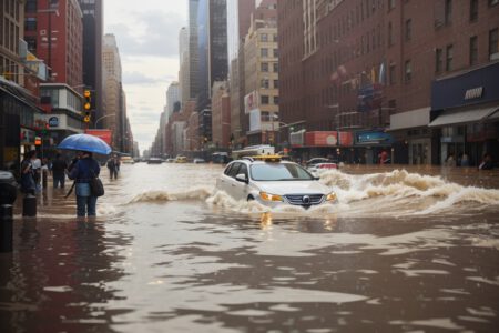
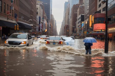
New York City, the largest and most populous city in the United States, is no stranger to flooding. The city is surrounded by water on three sides and has a complex network of rivers, creeks, canals, and wetlands. The city also has a long history of urban development, population growth, and infrastructure expansion that have altered its natural drainage and increased its vulnerability to flooding.
Causes of Flooding in NYC
There are several factors that contribute to flooding in NYC, including:
- Coastal storms: NYC is exposed to various types of coastal storms, such as hurricanes, tropical storms, nor’easters, and extratropical cyclones. These storms can bring strong winds, heavy rain, storm surges, and high waves that can inundate low-lying areas along the coast and cause erosion and damage to coastal structures. Some of the most devastating coastal storms that have hit NYC include the 1938 New England Hurricane, Hurricane Donna in 1960, Hurricane Sandy in 2012, and the remnants of Hurricane Ida in 2021.
- Heavy rainfall: NYC can experience intense rainfall events that can overwhelm its drainage system and cause flash flooding in urban areas. The city’s drainage system consists of a combined sewer system that collects both stormwater and wastewater and transports them to treatment plants. However, during heavy rain events, the system can reach its capacity and discharge excess water into nearby waterways through outfalls. This can result in sewage contamination and water quality degradation. Moreover, the city’s impervious surfaces, such as roads, buildings, and parking lots, reduce the infiltration of rainwater into the soil and increase the runoff volume and velocity. Some of the recent heavy rainfall events that have caused flash flooding in NYC include Tropical Storm Henri in 2021, Tropical Storm Fay in 2020, and a record-breaking downpour in 2023.
- Sea level rise: NYC is also facing the threat of sea level rise due to climate change. According to the New York City Panel on Climate Change (NPCC), the sea level around NYC has risen by about 1.1 feet since 1900 and is projected to rise by another 1.6 to 4.5 feet by 2100. Sea level rise can increase the frequency and severity of coastal flooding, especially during high tides and storm surges. It can also exacerbate coastal erosion, saltwater intrusion, and groundwater flooding.

Areas Affected by Flooding in NYC
Flooding in NYC can affect various areas depending on the type and magnitude of the flood event. Some of the most flood-prone areas in NYC include:
- Coastal zones: These are areas that are adjacent to or near the coast and are vulnerable to coastal storms and sea level rise. According to the NYC Department of City Planning (DCP), there are about 520 miles of coastline in NYC and about 400,000 people live within the current 100-year floodplain. Some of the coastal zones that have experienced severe flooding include Lower Manhattan, Coney Island, Rockaway Peninsula, Staten Island’s South Shore, and Long Island City.
- Inland areas: These are areas that are located away from the coast but are susceptible to flash flooding from heavy rainfall. According to the NYC Department of Environmental Protection (DEP), there are about 400 locations in NYC that are designated as chronic flooding areas. These are areas where flooding occurs at least once every five years due to inadequate drainage capacity or local topography. Some of the inland areas that have experienced flash flooding include Queens Boulevard, Brooklyn-Queens Expressway, Belt Parkway, Prospect Park Expressway, and parts of Harlem.
- Basement apartments: These are residential units that are located below ground level or partially below ground level and are often illegal or unregulated. According to a report by the Pratt Center for Community Development, there are about 114,000 basement apartments in NYC that house about 312,000 people. These units are often poorly ventilated, lack natural light, and have inadequate fire safety measures. They are also prone to flooding from groundwater seepage or sewer backups during heavy rain events. Many basement apartment residents lost their lives or their belongings during Hurricane Sandy and Hurricane Ida.
Property Losses from Flooding in NYC
Flooding in NYC can cause significant property losses for homeowners, renters, businesses, and public facilities. According to a study by FEMA, the annualized flood loss for NYC is estimated at $1.7 billion. This includes direct losses from structural damage and content damage as well as indirect losses from business interruption and displacement costs.

Some of the major flood events that have caused substantial property losses in NYC include:
- Hurricane Sandy in 2012: This was the most destructive and costly storm in NYC’s history. It caused widespread flooding, power outages, and transportation disruptions across the city. According to the NYC Office of Management and Budget (OMB), the total damage and losses from Sandy were estimated at $19 billion. This includes $6.6 billion in damage to public infrastructure and facilities, $5.7 billion in damage to private buildings and contents, and $6.7 billion in losses from business interruption and displacement.
- Remnants of Hurricane Ida in 2021: This was the deadliest rain event in NYC’s history. It triggered record-breaking rainfall and flash flooding across the city. According to the NYC Emergency Management (NYCEM), the preliminary damage and losses from Ida were estimated at $3.7 billion. This includes $1.9 billion in damage to public infrastructure and facilities, $1.4 billion in damage to private buildings and contents, and $0.4 billion in losses from business interruption and displacement.
- Record-breaking downpour in 2023: This was the wettest day ever recorded in NYC’s history. It dumped more than 7 inches of rain in less than 24 hours over parts of the city. According to the NYCEM, the preliminary damage and losses from the downpour were estimated at $1.2 billion. This includes $0.6 billion in damage to public infrastructure and facilities, $0.5 billion in damage to private buildings and contents, and $0.1 billion in losses from business interruption and displacement.
Conclusion
NYC flooding is a recurring challenge that poses serious risks to the city’s people, property, and environment. The city has been experiencing more frequent and intense flood events due to coastal storms, heavy rainfall, and sea level rise. These events have affected various areas of the city, especially coastal zones, inland areas, and basement apartments. They have also caused significant property losses for the public and private sectors.
The city has been taking various measures to reduce its flood risk and enhance its flood resilience, such as updating its flood maps, strengthening its building codes, improving its drainage system, restoring its natural habitats, implementing green infrastructure, installing flood barriers, and developing emergency plans. However, these measures may not be enough to cope with the changing climate and the growing population. The city needs to continue to invest in its flood mitigation and adaptation strategies, engage with its stakeholders and communities, and coordinate with its regional partners to ensure a safe and sustainable future for NYC.